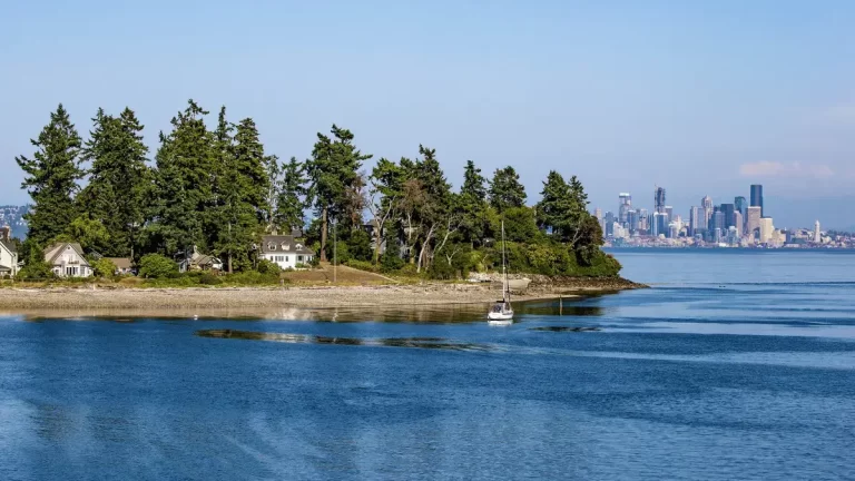
Seattle sits between two mountain ranges. The Olympic Mountains rise to the west across Puget Sound, and the Cascade Range runs the entire eastern horizon. On a clear day, you can count peaks from the Space Needle without a map.
I have driven out to most of these Seattle mountains. Some are 45 minutes away and some take half a day, but all of them are worth it if you plan right.
Important Links: Book a Mount Rainier Day Tour | Find Hotels Near Rainier
Note: While Seattle has no mountains in the city limits, the nearby Seattle mountains are Mount Rainier, Mount Si, Olympic Mountains, Mount St. Helens, Mount Adams, and Mount Baker. You cannot see all these mountains from Seattle, but they’re all just a short drive away.

How to Plan a Mountain Day Trip From Seattle
Before you go, three things matter: distance, road conditions, and passes.
Most Cascade hikes require a Discover Pass ($30/year or $10/day) or a Northwest Forest Pass ($30/year or $5/day). Buy them at trailheads or online before you leave.
Mount Rainier needs a separate national park entry fee, though an America the Beautiful Pass covers it.
Parking at Mount Si, Rainier, and popular Snoqualmie trails fills before 9am on weekends, so if you are planning a summer Saturday hike, leaving by 6am is not too early. Check road conditions before going anywhere in winter.
WSDOT’s pass report page is the fastest way to confirm whether Snoqualmie Pass, Stevens Pass, or the Nisqually entrance to Rainier is open.
If you want a guided experience without the logistics, a day tour from Seattle to Rainier removes the parking stress. It also gives you a local guide who knows the trails. Browse Mount Rainier day tours here.
 Mount Rainier
 Mount Si
 Olympic Mountains
 Mount St. Helens
 Mount Adams
 Mount Baker
 Glacier Peak
 Mount Rainier from Seattle
 Mount Rainier in Winter
The 7 Mountains Near Seattle
Important Links: Book a Mount Rainier Day Tour | Find Hotels Near Rainier
1. Mount Rainier – 14,411 Feet
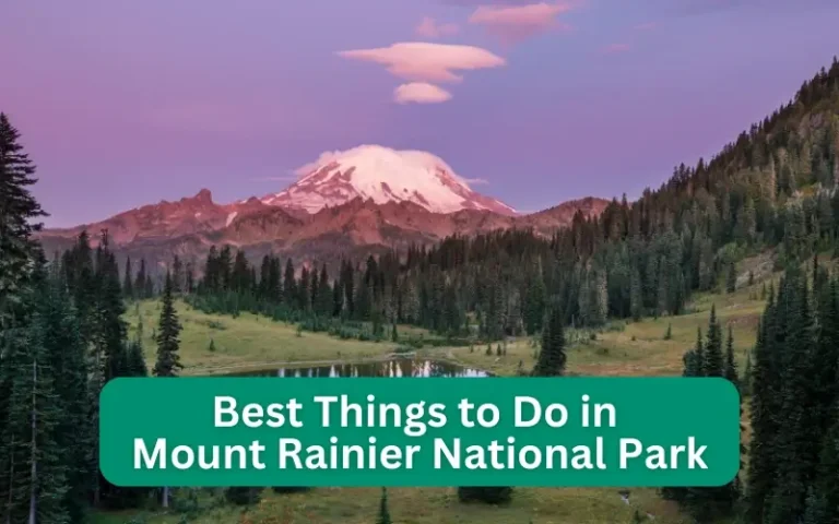
Mount Rainier is the mountain you can see from the Space Needle on a clear morning. It’s the one that stops you mid-sentence when it rises above the clouds to the south. And it’s among Seattle’s top nearby attractions.
Mt. Rainier sits 59 miles southeast of Seattle and stands at 14,411 feet. It’s both the highest peak in Washington and the most glaciated volcano in the contiguous US.
The best city vantage points are Kerry Park on Queen Anne Hill, Alki Beach, and the Space Needle observation deck. For a full list of where to catch the view from within Seattle, see my guide to the best sunset spots in Seattle.
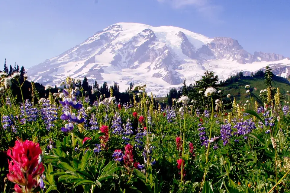
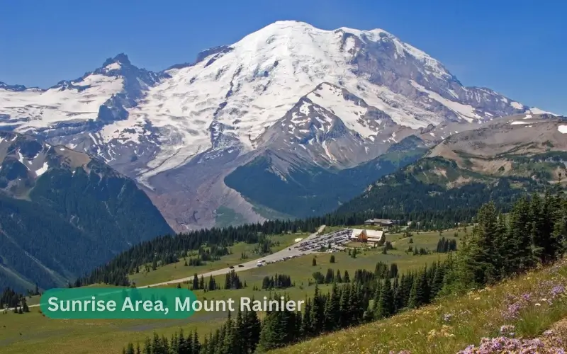
The Nisqually Entrance is the closest to Seattle at about a 2-hour drive. Paradise is the main destination inside the park. In summer, the meadows fill with wildflowers and in winter the same area gets deep snow with ranger-led snowshoe tours on weekends from December through March.
For hikers: The Rampart Ridge Loop at Longmire is a solid moderate trail with forest and ridge views. For something more demanding, the Wonderland Trail circles the entire mountain at 93 miles.
But most people hike sections of it over multiple days. Read my full guide to things to do in Mount Rainier National Park for a full breakdown of trails and activities.
For non-hikers: Drive to Paradise, walk the paved path to the visitor center, and take in the glacier views. It is genuinely impressive without any serious effort.
Guided tours: The expert-led Rainier National Park highlights tour covers the main viewpoints with a picnic stop at Paradise, which takes the planning off your plate entirely. Check availability and pricing here.
Staying near Rainier: Mountain Meadows Inn and Chalet Suites in Ashford sits 10 km from the park entrance with a sun terrace, garden views, free WiFi, and free parking. For more options, read my full guide to places to stay near Mount Rainier.
Important Links: Book a Mount Rainier Day Tour | Find Hotels Near Rainier
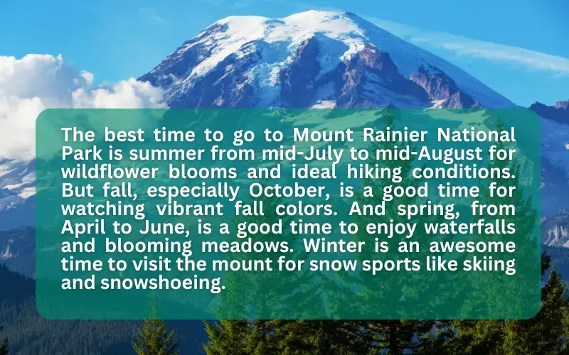
Best time to visit: July through September for hiking, December through March for snow activities. Read the full seasonal breakdown in my guide to the best time to visit Mount Rainier National Park.
Pros of visiting Mount Rainier:
- Closest major mountain to Seattle at under 2 hours
- Active year-round with hiking, snowshoeing, and wildflower walks
- National park infrastructure makes it accessible for all fitness levels
Cons of visiting Mount Rainier:
- Crowds are heavy from July through August, especially at Paradise
- Parking fills early on weekends
- Some roads close in winter, limiting access to the park interior
2/ Mount Si – 4,167 Feet
Mount Si is the hike locals do first. It sits 35 miles east of Seattle on I-90, about 45 minutes from downtown. At 4,167 feet it is modest compared to Rainier, but the trail gains 3,150 feet over 4 miles, which means you feel every foot of it.
You can see Mount Si from parts of Seattle on clear days. It looms directly over the town of North Bend and is hard to miss as you drive east on I-90.
The main trail is 8 miles round trip with a rocky scramble at the top. At the summit you see Snoqualmie Valley, North Bend, and on clear days, Seattle in the distance.
The trail gets full sun on the upper half, so bring water. Little Si is the easier option for families at 5 miles round trip with about 1,200 feet of gain, same views with less intensity. You need a Discover Pass for parking at the trailhead.
If you recognize Mount Si from TV, you are not wrong. It was filmed repeatedly as a backdrop in “Twin Peaks.”
Best time to visit: Spring through fall. The upper scramble becomes dangerous in winter when the trail ices over.
3/ Olympic Mountains – Up to 7,980 Feet
The Olympics are visible from downtown Seattle to the west. On clear days from Pike Place Market, Alki Beach, or the ferry to Bainbridge Island, you can see the ridgeline across Puget Sound.
The range tops out at Mount Olympus at 7,980 feet, though you cannot see Olympus itself from Seattle because it sits deep inside the peninsula.
Peaks like Mount Constance (7,756 feet) and The Brothers (6,842 feet) are the ones you actually see from the city, sitting closer to the eastern edge of the range and facing Seattle directly.
Getting to the Olympics takes about 2 hours. You take the ferry from Seattle to Bainbridge Island, then drive north on Highway 101 to Port Angeles.
Hurricane Ridge is the most accessible viewpoint inside Olympic National Park. You can take a drive from Port Angeles to the ridge taking about 45 minutes to see panoramic views of the mountain range and the Strait of Juan de Fuca below.
For hikers: The Hurricane Hill Trail at Hurricane Ridge is 3.2 miles round trip and has some of the best mountain views in the park.
The Hoh Rainforest trails on the west side are a completely different experience, flat and ancient. You’ll walk through old-growth moss-covered forest with almost no elevation gain.
For wildlife: The Olympics have one of the densest Roosevelt elk populations in the US, and you will almost certainly spot a herd near the Hoh Rainforest or around Hurricane Ridge.
Best time to visit: Summer for full park access. Hurricane Ridge Road closes on weekdays in winter. But it reopens on weekends as a small ski and snowshoe area with one of only three remaining lift-served downhill runs inside a US national park.
Pros of visiting the Olympic Mountains:
- Visible from downtown Seattle to the west, the only range with that distinction
- Diverse ecosystems in one park: glaciers, temperate rainforest, coastline, and alpine meadows
- Less crowded than Rainier during peak summer season
Cons of visiting the Olympic Mountains:
- Requires a ferry crossing, which adds both time and cost
- Hurricane Ridge Road closes on weekdays in winter
- The west side of the park, including the Hoh Rainforest, is a 4-plus-hour drive from Seattle
4/ Mount Baker – 10,786 Feet
Mount Baker sits 86 miles north of Seattle near Bellingham, about 2.5 hours by car. At 10,786 feet, it’s Washington’s third-highest peak.
Mt. Baker is also one of the snowiest places on earth, holding the world record for single-season snowfall at a ski area: 95 feet in the 1998 to 1999 season.
You can see Mount Baker from Seattle on very clear days from north Seattle neighborhoods like Phinney Ridge, though visibility depends heavily on conditions.
For skiers: Mount Baker Ski Area receives an average of 641 inches of snow per season, more than almost any resort in North America.
The terrain leans intermediate to advanced and there is no on-mountain lodging, so most people stay in Bellingham the night before.
For hikers: The Chain Lakes Loop near Artist Point is one of the most scenic hikes in Washington at 6.5 miles with views of both Baker and Mount Shuksan.
Drive to the Artist Point parking lot at the end of the Mount Baker Highway. The road typically opens in late July and closes again with the first heavy fall snowfall.
Best time to visit: Late July through September for hiking. November through April for skiing and snow sports.
4/ Mount St. Helens – 8,363 Feet
Mount St. Helens is about 3 hours south of Seattle via I-5 and State Route 504, and you cannot see it from the city. But if you are spending time in Seattle and have a full day free, this is the most dramatic destination in the Pacific Northwest.
The 1980 eruption blew 1,300 feet off the top of the mountain and leveled 230 square miles of forest in minutes.
Driving up Route 504, the scale of that destruction is still visible 45 years later, with fallen logs carpeting the hillsides and Spirit Lake sitting below the open crater.
Johnston Ridge Observatory sits directly across from the blast zone and has exhibits that explain exactly what happened and how the ecosystem has slowly recovered.
You can hike to the crater rim via the Monitor Ridge route (permit required, available at recreation.gov). The 10-mile round trip is strenuous and requires good fitness and solid gear.
Also, always remember that permits sell out months in advance, especially for summer weekends.
Best time to visit: Late spring through fall. Some roads close in winter.
6/ Mount Adams – 12,280 Feet
Mount Adams is Washington’s second-highest peak and arguably its most overlooked. It sits about 4 hours southeast of Seattle, which makes it a stretch as a day trip and better suited to an overnight or weekend visit. Most people who come here are serious climbers or backpackers.
You can technically see Mount Adams from parts of Seattle, but it is partially blocked by higher Cascade peaks in the foreground and sits far enough east that clear sightlines are rare.
The South Climb is the main mountaineering route, a non-technical ascent that requires no rope skills. But it demands good fitness across a long day with significant elevation gain.
The Pacific Crest Trail runs through the adjacent wilderness for backpackers who want multiple days in the area.
Best time to visit Mount Adams: July through September when the access roads and upper routes are clear of snow.
Activities:
You can ski, snowboard, and climb the mountain north of Seattle. Many climbers use the Easton Glacier route in summer. There’s a ski area for winter sports, plus hiking trails and lakes for fishing.
Scenic Highlights:
The mountain near Seattle looks beautiful with its snowy peak. You can hike through forests and past mountain lakes, or see the mountain from nearby cities like Bellingham.
Wildlife: You might see mountain goats, black bears, and many types of birds. The forest has lots of different plants too.
How to Get There: Drive about 2.5 hours north of Seattle on Highway 542, near the city of Bellingham.
Best Time to Visit: Come in winter for skiing and snow activities, orin summer for hiking and climbing. The ski season usually runs from November to April with good snow.
7/ Glacier Peak – 10,541 Feet
Glacier Peak is the least accessible volcano in the Pacific Northwest. It sits 70 miles northeast of Seattle inside the Glacier Peak Wilderness and has no road leading to it. Every approach is a multi-day backpacking trip, which keeps the crowds low.
On clear days, you can see Glacier Peak from Seattle by looking to the northeast above the Cascades. It’s less prominent than Rainier but visible if you know the skyline well.
If you are a skilled hiker or mountaineer, the Ptarmigan Traverse is one of the best multi-day alpine routes in the country. But it requires experience with glacier travel and solid route-finding ability. For most Seattle visitors, Glacier Peak is background scenery. Rainier, Baker, and Si are the better day trip targets.
Best time to visit: August through mid-September, when the high trails are snow-free.
Seattle Mountains Removed: Quick Story of the Denny Regrade
Seattle’s famous hills and mountains have been moved or reshaped by regrading projects. But none was as dramatic as the removal of Denny Hill.

Between 1897 and 1930, the city flattened the hill to make room for development.
The goal was simple: create more space for businesses and buildings. Over 4 million cubic yards of dirt were moved across five projects to level the area. This created the flat land now known as the Denny Regrade, today.
The regrading reshaped the area between downtown and Queen Anne, changing the city’s retail district.
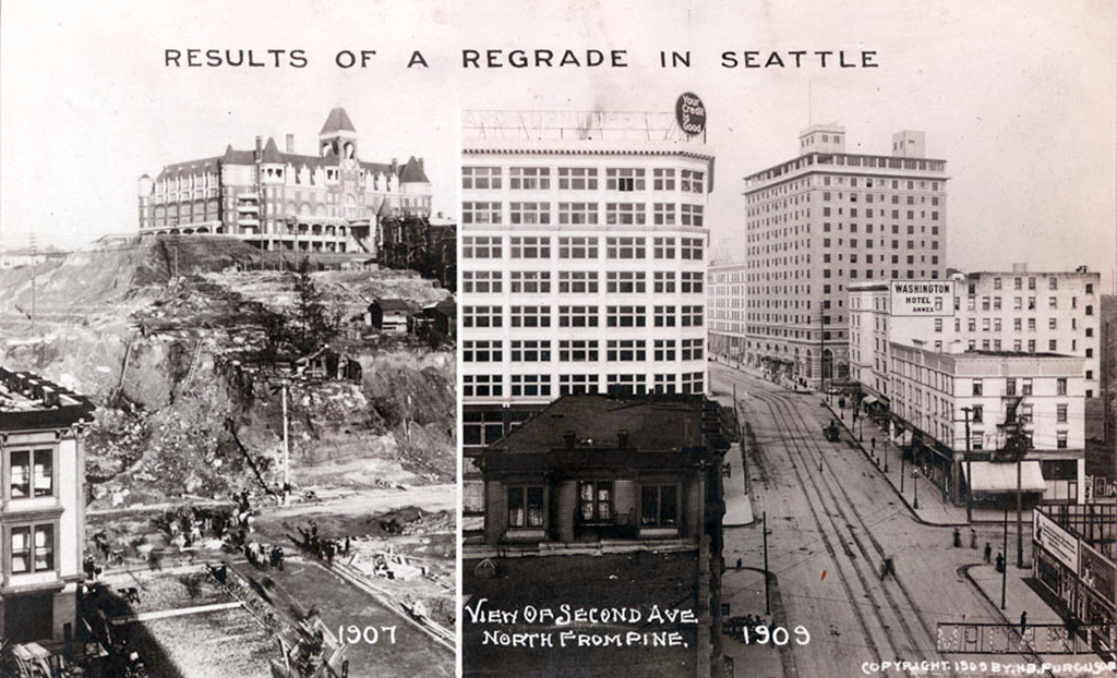
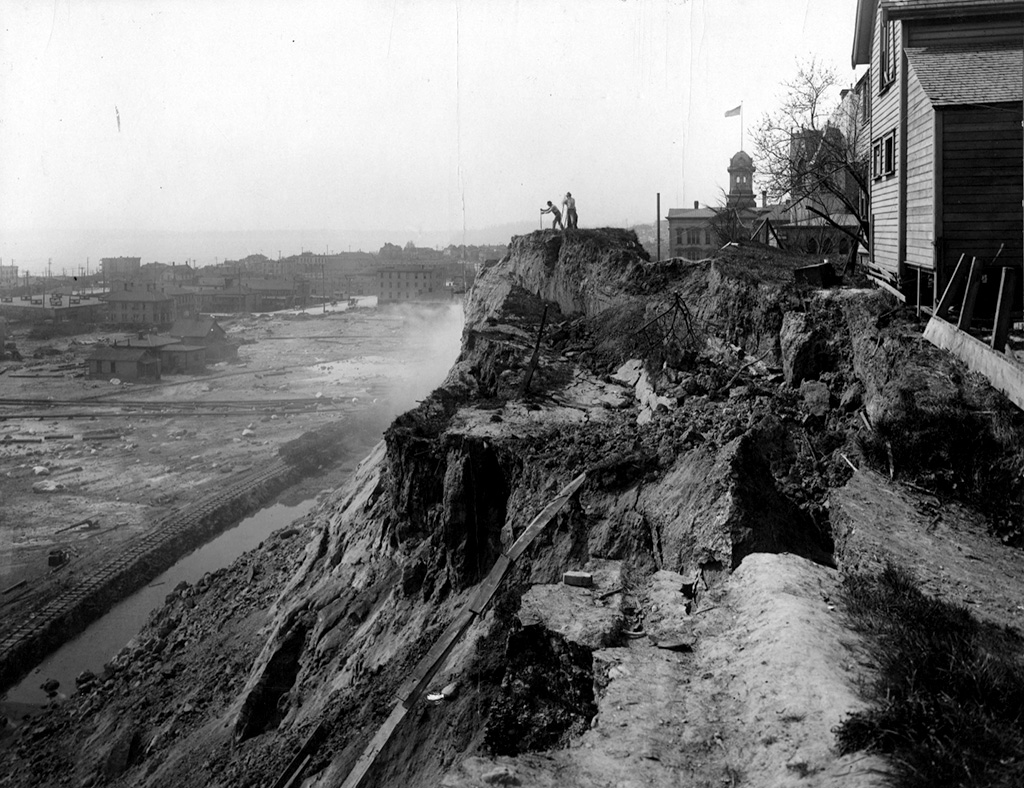
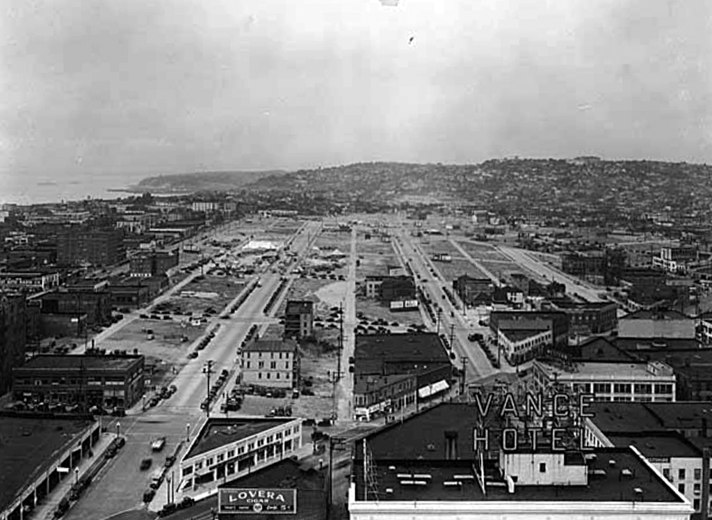
While Denny Hill was removed, other hills like Queen Anne and Capitol Hill also saw some changes. The project dramatically altered Seattle’s landscape, once known for its “Seven Hills,” leaving behind a city much more suited for modern development.
FAQs About Mountains Near Seattle
Now let me answer a few questions you might have about Seattle mountains.
How Close Are Seattle Mountains to the City?
It depends on which mountain. Mount Si is 35 miles from downtown, about 45 minutes on I-90. Mount Rainier is 59 miles southeast, about 2 hours via the Nisqually Entrance. The Olympic Mountains require a ferry crossing plus another 2-hour drive to Hurricane Ridge. Mount Baker is 86 miles north, about 2.5 hours via Bellingham.
Which Mountain Can I See From Seattle?
On a clear day, you can see Mount Rainier to the south-southeast, the Olympic Mountains to the west, Mount Baker to the north, and Glacier Peak to the northeast. The Cascade Range fills the entire eastern horizon. Mount Constance and The Brothers are the most visible Olympic peaks from downtown Seattle.
Can You See Mt. Rainier From Seattle?
Yes, on clear days, you can clearly see Mt Rainier from Seattle. The best views are from Kerry Park on Queen Anne Hill, the Space Needle observation deck, Alki Beach, and the shores of Lake Washington. Summer months have the best visibility, though wildfire smoke can reduce it in July and August.
What Mountains Are in the Seattle Area?
The Seattle area sits between two major ranges. The Cascade Range to the east includes Mount Rainier (14,411 feet), Mount Baker (10,786 feet), Glacier Peak (10,541 feet), Mount Adams (12,280 feet), Mount St. Helens (8,363 feet), and Mount Si (4,167 feet). The Olympic Mountains to the west on the Olympic Peninsula include Mount Olympus (7,980 feet), Mount Constance (7,756 feet), and The Brothers (6,842 feet).
What’s the Most Famous Mountain Near Seattle?
Mount Rainier is the most famous mountain near Seattle. It is visible from the city on clear days, sits inside a national park, and dominates the southern horizon from nearly every elevated viewpoint in Seattle. It is also the highest peak in Washington and the most glaciated volcano in the contiguous United States.
What’s the Elevation of Mountains Near Seattle?
Mount Rainier is the highest at 14,411 feet. Mount Adams is second at 12,280 feet. Mount Baker sits at 10,786 feet, Glacier Peak at 10,541 feet, and Mount St. Helens at 8,363 feet. The Olympic Mountains top out at Mount Olympus at 7,980 feet, while Mount Si, the most popular hike near Seattle, reaches 4,167 feet.
What’s the Best Hiking Season in Washington Mountains?
June through October for most trails. Lower elevation hikes like Mount Si are accessible from April through November, with snow melting early at these elevations.
Mid-elevation Cascade trails such as Heather Lake, Snow Lake, and Lake 22 typically clear from June through October. High alpine routes near Rainier’s Paradise and Baker’s Artist Point do not clear until mid-July and can close with the first heavy snowfall in October. For winter hiking near Seattle, stick to lower trails with good drainage and bring microspikes from November onward.
Final thoughts
The mountains around Seattle are accessible without requiring mountaineering experience for any of the seven on this list, except the technical routes on Glacier Peak and upper Adams.
If you are here for a few days and want one mountain experience, Rainier is the answer. Book a guided tour if you do not want to deal with parking and planning logistics.
If you have a full week and want variety, add Mount Si for a local hiking challenge and Baker or Stevens Pass for snow. For more ideas on what to do, see my Seattle tourist attractions guide and thingsto do in Seattle in May.
Important Links: Book a Mount Rainier Day Tour | Find Hotels Near Rainier
Updated May 2026. Mountain elevations and park access conditions are accurate as of this writing. Always check WSDOT road conditions and individual park websites before heading out.